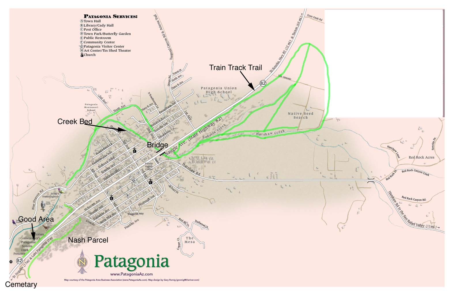
The map below shows some suggested routes to walk through town for the Christmas Bird Count.
Several of these suggested routes (indicated in green) follow the creek bed, which at this time of year is usually dry.
The green paths marked on the upper right of the map begin just north of the bridge at the north edge of town, where a gate allows entry to the Train Track Trail. You may follow the elevated old rail roadbed, or walk along the creek (again, generally dry).
Click on the link below to load the map as a separate page.
